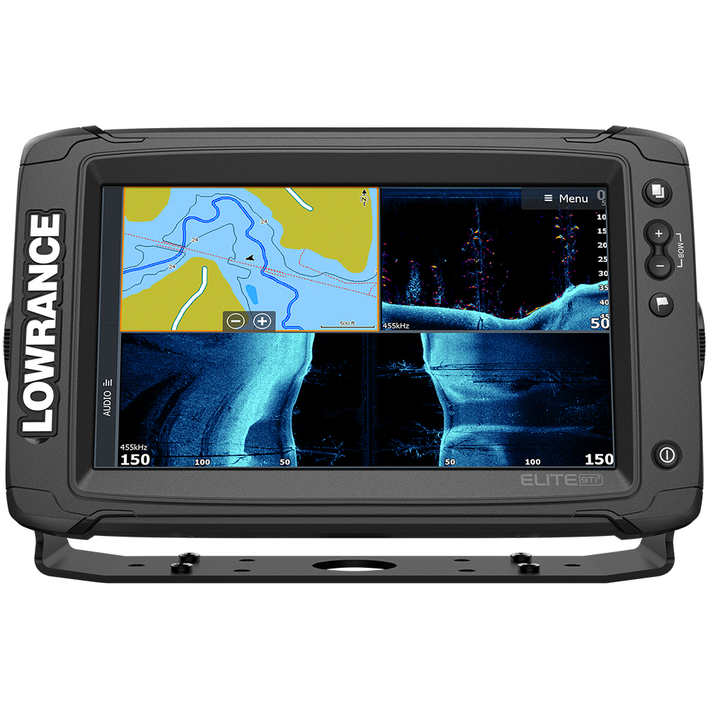
Lowrance Elite-9 Ti² Combo w/Active Imaging 3-in-1 Transom Mount Transducer & US/Canada Nav+ Chart
$807.86
- Condition: New
- Manufacturer Name: Lowrance
- Cartography Brand: Navionics/C-Map/Lowrance/CMOR
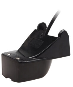
- Included Transducer: 000-14489-001
- Screen Size: 9″
- Touchscreen: Yes
- Transducer Included: Yes
- Manufacturer Part Number: 000-14649-001
- Universal Product Code: 9420024175361
- Google Merchant Category: ELECTRONICS > MARINE ELECTRONICS > MARINE CHARTPLOTTERS & GPS
Out of stock
Description
https://www.youtube.com/embed/QcvkCLCXx38
https://www.youtube.com/embed/YwJ-l50ccKM
https://www.youtube.com/embed/H_R3-eC9iy0
https://www.youtube.com/embed/9_L000wM4k0
https://www.youtube.com/embed/H3zrxS4Ggmw
https://www.youtube.com/embed/5pC-NJxvW9s
https://www.youtube.com/embed/DWe-mHKj0QI
https://www.youtube.com/embed/JHjK8wXPaiQ
https://www.youtube.com/embed/Tr358n5zPiM
https://www.youtube.com/embed/MlS_GvzyZ7Y
https://www.youtube.com/embed/OQaR69MbnFk
https://www.youtube.com/embed/RzlplTGgK-k
https://www.youtube.com/embed/Z25fxOjayjI
https://www.youtube.com/embed/_CTvlTQPcNE
Elite-9 Ti² Combo with Active Imaging 3-in-1 Transom Mount Transducer & US/Canada Nav+ Chart
With the Elite Ti2, you get more advanced fishfinding features and connectivity, without the premium price.
From high-detail Active Imaging™ sonar, FishReveal™, built-in Genesis Live real-time mapping and enhanced screen clarity and target separation to features that make your life easier on the water, like an easy-to-use touchscreen, wireless networking, smartphone notifications and trolling motor/Power Pole® integration – Elite Ti2 was designed to help you have an easier time finding fish.
Active Imaging 3-in-1 sonar (CHIRP, SideScan and DownScan) and 2-in-1 sonar (SideScan and DownScan) lift Elite Ti2 fishfinding performance to another level, offering offer greater resolution, clarity and contrast at a range unmatched by any fishfinder in its category.
Elite Ti2 delivers more powerful navigation features with preloaded C-MAP® US Inland mapping , C-MAP Easy Routing + Navionics® Autorouting and Genesis Live real-time mapping.
You will have a much easier time targeting key areas with US Inland fishing map that features 1-foot contours on more than 4,000 lakes. If you would rather create your own maps of a favorite fishing spot or a lake without detailed mapping, take advantage of the built-in Genesis Live real-time mapping capability to create your own, exclusive ½-foot contour maps live on the screen of your Elite Ti2 display.
The Elite Ti2 wireless networking allows you to share sonar, waypoint and route data wirelessly between Elite Ti2 displays, removing the need to run cable.
With new smartphone notification capability built into Elite Ti2, you can keep your eyes on the fish and never miss another text or call; or turn off notifications for uninterrupted fishing.
Key Features:
- Includes Active Imaging 3-in-1 Sonar (CHIRP/Side/Down) Transducer
- Active Imaging 2-in-1 Sonar (Side/Down) Ready optional transducer required
- C-MAP Genesis Live
- Smartphone Notifications
- Wireless Networking
- FishReveal™ Smart Target View
- Preloaded C-MAP US Inland mapping with a multitude of mapping options, including C-MAP, Navionics® and more
- C-MAP Easy Routing, Navionics Autorouting capability
- Easy-to-use, high-resolution touchscreen display
- SmartSteer™ control for Xi5 Trolling Motor
- Integrated wireless connectivity
- NMEA 2000® engine support
- Enhanced Surface Clarity lets you see more fish targets near the surface
- Quick Access Control Bar provides one–touch access to system controls
Enhanced display technology
High-resolution, 9-inch SolarMAX™ display that makes it easier to identify fish and structure with new, enhanced screen clarity and target separation.
Easy-to-use touchscreen
Touchscreen provides fast, fingertip access to all Elite-Ti2 features
FishReveal Smart Target View
Makes fish easier to see on DownScan Imaging™ by combining clear CHIRP sonar fish targets with superior, high-resolution views of bottom detail, structure and bait fish.
Active Imaging
See structure and cover with a new level of high-resolution detail and unmatched sidescan range with new, Lowrance 3-in-1 Active Imaging featuring CHIRP sonar, SideScan and DownScan Imaging™ and Active Imaging 2-in-1 sonar with SideScan and DownScan.
Genesis Live
Update the mapping of your favorite fishing spot or map unmapped areas with ½ foot contours – in real time – on the screen of your fishfinder/chartplotter with C-MAP Genesis Live.
Preloaded High-Detail Mapping
Fish new water like a pro with preloaded US Inland mapping that features 4,000 lakes with 1-foot contours. Narrow your search for productive water, easily locating fish-holding structure like ledges, drop offs and cover.
Wireless Networking
Share sonar, mapping, waypoint and route data between Elite Ti2 displays without connecting a cable with the new wireless networking capability of Elite Ti2.
TrackBack™
Scroll back through your sonar, SideScan or DownScan history to review structure or fish targets and mark the location with a waypoint.
Enhanced Color Palettes
Customize the look and feel of your display with the enhanced color and contrast of Elite Ti2 color palettes, which make it even easier to distinguish fish from structure, the bottom and each other.
Optional chart upgrades
Optional Americas chart upgrades include C-MAP Insight Pro, C-MAP Lake Insight HD, C-MAP MAX-N, Navionics® HotMaps® Premium, Navionics + and Fishing Hotspots® PRO.
Built-in wireless connectivity
Shop, purchase and download mapping upgrades directly to Elite Ti2 displays via the integrated GoFree™ Cloud interface.
Integration and System Control
Enjoy touchscreen control of Power-Pole® Shallow Water anchors, Motorguide® Xi5 trolling motors and the SonicHub®2 Marine Audio server. Get instant access to system controls from the Quick Access Control Bar.
microSD card slot
Overview
Display – 9″
Resolution – 800W x 480H
Backlighting – LED
Power Output – Max 500W RMS
Media Port – 1 microSD slot
Power Supply (Supply voltage) – 12 vDC (10-17 vDC min-max)
Current Draw [kW] – 12 W (0.9 A @ 13 vDC)
Dimensions
Product Width: 10.5”
Product Depth: 2.7”
Product Height: 6.2”
Sonar
Active Imaging 3-in-1
DownScan Imaging™ at 455 kHz: Max 300 ft / 91 m
SideScan Imaging at 455kHz: Max 300 ft./91 m to each side
CHIRP Sonar High Range/200 kHz: 1000 ft / 305 m
CHIRP Sonar Med Range/83 kHz: 1000 ft / 305 m
Available Sonar Frequencies
Low/Mid/High CHIRP
50/83/200 kHz Broadband
455/800 kHz SideScan/DownScan imaging
Depth Alarm – Yes
Shallow Alarm – Yes
Temperature Readings – Yes
Transducer Type – 9-pin Connection, with optional 9-pin to 7-pin adapter; Multiple Selections Lowrance® and Airmar®
GPS Navigation
Navigation: Routes – 100
Navigation: Waypoint Storage – 3000
Plot Trails – Up to 100 trails with up to 10,000 points per trail
GPS Antenna Type – 10kHz Internal high-sensitivity WAAS/EGNOS/MSAS
GPS Alarms – Yes
Custom Mapping – Optional Americas chart upgrades include C-MAP Insight PRO, C-MAP Lake Insight HD, C-MAP MAX-N, Navionics® HotMaps® Premium, Navionics + and Fishing Hotspots® PRO.
Networking
NMEA 0183 and NMEA 2000®
Technical/Environmental
Waterproof Standard/Rating: IPx6 and IPx7
Additional information
| Weight | 146.40 oz |
|---|---|
| Dimensions | 13 × 10 × 9 in |
| Cartography Brand | |
| Included Transducer | |
| Screen Size | |
| Touchscreen | |
| Transducer Included | |
| Condition | New |
| Google Merchant Category | ELECTRONICS > MARINE ELECTRONICS > MARINE CHARTPLOTTERS & GPS |
| Manufacturer Name |
Reviews (0)
Be the first to review “Lowrance Elite-9 Ti² Combo w/Active Imaging 3-in-1 Transom Mount Transducer & US/Canada Nav+ Chart” Cancel reply
You may also like…
Related products
GPS - Fishfinder Combos
GPS - Fishfinder Combos
Antenna Mounts & Accessories
GPS - Fishfinder Combos
Raymarine Axiom+ 9 RV – 9″ Chartplotter/Fishfinder w/RV-100 T/M Transducer & Navionics+ Chart
GPS - Fishfinder Combos
Antenna Mounts & Accessories
GPS - Fishfinder Combos
Antenna Mounts & Accessories
GPS - Fishfinder Combos
Raymarine Element™ 9 HV Chartplotter & Fishfinder Combo – No Transducer
GPS - Fishfinder Combos
GPS - Fishfinder Combos
Raymarine Axiom+ 9 RV – 9″ Chartplotter/Fishfinder w/RV-100 T/M Transducer
GPS - Fishfinder Combos
Raymarine Axiom+ 9 RV 9″ Chartplotter/Fishfinder w/Lighthouse North America Chart
GPS - Fishfinder Combos
GPS - Fishfinder Combos
GPS - Fishfinder Combos
Antenna Mounts & Accessories
Antennas
GPS - Fishfinder Combos
Humminbird HELIX 12® CHIRP MEGA DI+ GPS G4N CHO Display Only
Antenna Mounts & Accessories
GPS - Fishfinder Combos
Antenna Mounts & Accessories
GPS - Fishfinder Combos
Antenna Mounts & Accessories
GPS - Fishfinder Combos
Antennas
Antenna Mounts & Accessories
GPS - Fishfinder Combos
Antenna Mounts & Accessories
GPS - Fishfinder Combos
Raymarine Axiom+ 9 RV – 9″ Chartplotter/Fishfinder w/Navionics+ Chart
GPS - Fishfinder Combos
GPS - Fishfinder Combos
Humminbird HELIX 15® CHIRP MEGA SI+ GPS G4N CHO Display Only
GPS - Fishfinder Combos
Raymarine Element 12 HV Combo w/HV-100 Transom Mount Transducer & Lighthouse North America Chart
Antennas
Antenna Mounts & Accessories
Antenna Mounts & Accessories
Antenna Mounts & Accessories
GPS - Fishfinder Combos
GPS - Fishfinder Combos
Antenna Mounts & Accessories
Antenna Mounts & Accessories
GPS - Fishfinder Combos
GPS - Fishfinder Combos









































Reviews
There are no reviews yet.