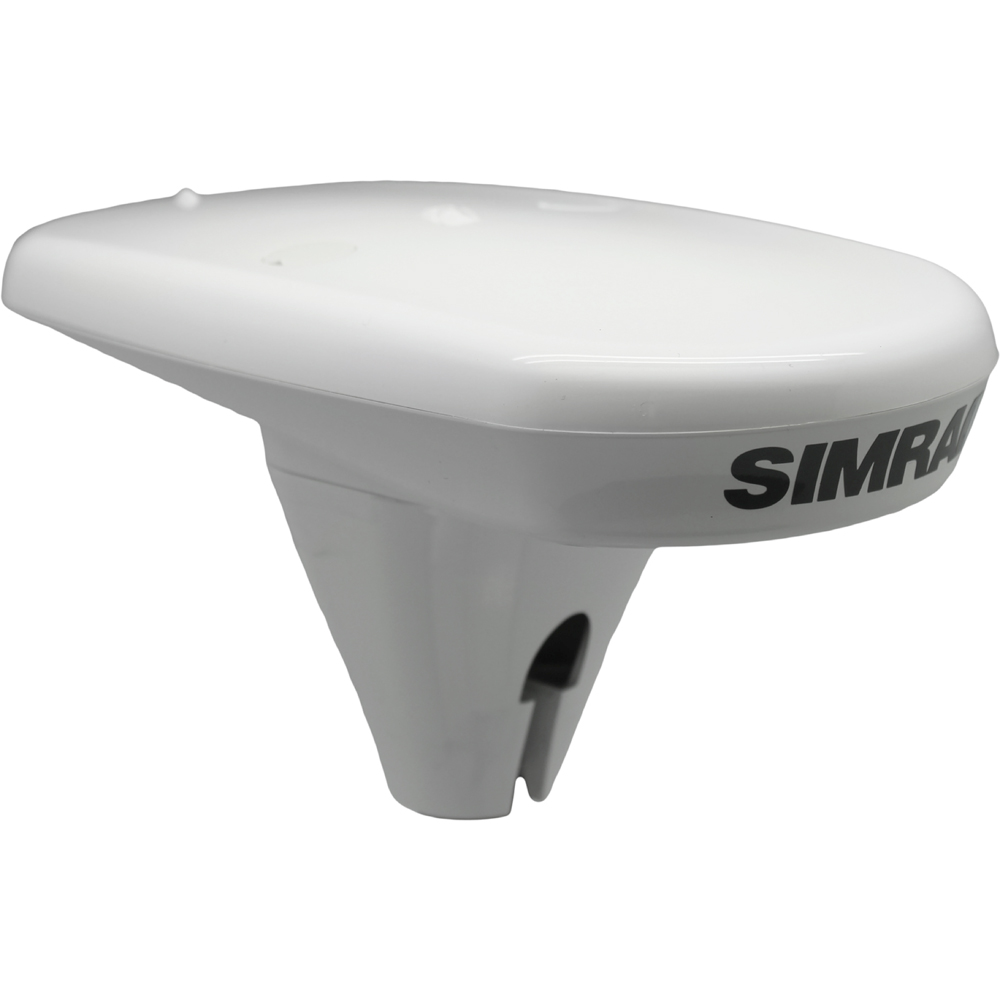
Simrad HS60 GPS Compass NMEA2000 – Cable not included
$765.46
- Condition: New
- Manufacturer Name: Simrad
- Data Interface: NMEA 2000
- Country of Origin: CHINA
- Manufacturer Part Number: 000-12308-001
- Universal Product Code: 9420024139516
- Harmonization Code: 9014.80.40.00
- Google Merchant Category: ELECTRONICS > MARINE ELECTRONICS
Out of stock
Description
HS60 GPS Compass NMEA2000 – Cable not Included
The Simrad HS60 GPS compass provides boaters with accurate heading and position data suitable for use with Simrad chartplotters, autopilots, radar, and AIS transponder systems. For applications such as autopilot, where precise heading information is required, the HS60 provides an all-in-one alternative to the traditional solution of a separate fluxgate compass and GPS receiver.
Features:
- Compass and GPS receiver in one
- Tracks heading, position, heave, roll, and pitch
- Suitable for use with Simrad autopilot systems
- 2° RMS heading accuracy with dual internal GPS antennas
- 1M differential positioning accuracy (using SBAS supports WAAS, EGNOS, MSAS & GAGAN)
- 3M positioning accuracy (GPS only)
- Maintains an accurate heading for up to 3 minutes during GPS outages
- Compact flush or pole-mounted design
- NMEA 2000® connectivity (NMEA 0183® optional)
The Simrad HS60 combines a high-speed 10 Hz, SBAS-compatible GPS receiver with integrated gyro and tilt sensors to provide smooth and accurate heading, position, heave, roll, and pitch information to Simrad chartplotters, autopilots, radar, and AIS systems.
10 Hz GPS Receiver
The HS60’s high-speed GPS receiver delivers accurate and reliable positioning, updated ten times every second for smooth tracking of fast-moving powerboats. Fast startup means you won’t get caught waiting for a position fix before you can get underway, with ‘hot start’ in less than a second and ‘cold start’ typically under a minute.
Enhanced Positioning with SBAS
With support for Satellite Based Augmentation Systems (SBAS) including WAAS (USA), EGNOS (Europe), MSAS (Japan) and GAGAN (India), the HS60 is able to use satellite-broadcast error correction data to deliver positional accuracy of up to 1M RMS, 95% of the time. Simrad COAST™ technology means the HS60 can even continue to deliver enhanced accuracy for up to 40 minutes if SBAS signal is lost, using the last error correction data received.
In areas or conditions where SBAS is unavailable, the HS60 delivers ‘single-point’ positioning with accuracy of up to 3M RMS (95%). Actual accuracy experienced depends on environmental factors, the number of satellites in view, satellite geometry, and SBAS coverage where available.
Accurate Heading with Dual GPS Antennas
The HS60 includes two separate GPS antennas within its compact casing, which are used to calculate heading with an accuracy of 2° RMS – greater accuracy than a magnetic fluxgate compass, without the cost and ongoing maintenance of a gyrocompass. With its dual GPS antennas, the HS60 provides an accurate heading even when your vessel is stationary, with a typical heading fix in less than ten seconds.
Integrated Gyro & Tilt Sensors
Onboard gyro and tilt sensors deliver heave, roll, and pitch information; offer faster and smoother heading updates than GPS alone; and provide heading updates during any temporary loss of GPS signal. Using these sensors, the HS60 is able to provide an accurate heading for up to three minutes during GPS outages, with an accuracy loss of no more than two degrees per minute and quick reacquisition of position once the signal has been reacquired.
Simple Installation with NMEA 2000® Connectivity
The compact and lightweight HS60 is supplied as a standalone system including mounting accessories. With GPS receiver, gyro and tilt sensors, and all other electronics integrated into the IP69 water-resistant antenna enclosure, there is no ‘black box’ required below deck.
The HS60 connects to Simrad autopilot systems, NSS evo2 and NSO evo2 chartplotter/multifunction displays, and other systems requiring a NMEA 2000®-connected compass or GPS. A single NMEA 2000® bus connection is required for both power and data, standard drop cable with 5-pin micro connector sold separately.Specifications:
- Reverse Polarity Protection: Yes
- Power Consumption: 2.0W nominal
- Power Supply (Supply Voltage): 8 to 36 VDC
- Grounding: Isolated to enclosure
- Humidity: 100% non-condensing
- Product Width:129mm / 5.1″
- Product Depth: 259mm / 10.2″
- Product Height: 45mm / 1.8″
- Baud Rates: 4800, 9600, 19200, 38400, 57600, 115200
- Correction I/O Protocol: RTCM SC-104
- Data I/O Protocol: NMEA 2000 (Optional NMEA 0183)
- Serial Ports: 2 full-duplex RS232 or 1 NMEA 2000
- Compass Safe Distance [mm]: 300
- Pitch/Roll Angle: 2°
- Rate of Turn: 90°/s maximum
- Receiver Type: GPS L1 Compass
- Heading Accuracy: 2° RMS
- Heading Fix: < 10s typical (valid position)
- Connectors: NMEA 2000 Connector: 5 Pin Male Micro Connector
- Reverse Polarity Protection: Yes
Additional information
| Weight | 40.0 oz |
|---|---|
| Dimensions | 11 × 11 × 6 in |
| Manufacturer Name | |
| Data Interface | NMEA 2000 |
| Google Merchant Category | ELECTRONICS > MARINE ELECTRONICS |
| Country of Origin | CHINA |
| Condition | New |
Reviews (0)
Be the first to review “Simrad HS60 GPS Compass NMEA2000 – Cable not included” Cancel reply
Related products
NMEA Cables & Sensors
NMEA Cables & Sensors
Compasses
Compasses
NMEA Cables & Sensors
NMEA Cables & Sensors
Compasses
NMEA Cables & Sensors
NMEA Cables & Sensors
NMEA Cables & Sensors
NMEA Cables & Sensors

Reviews
There are no reviews yet.